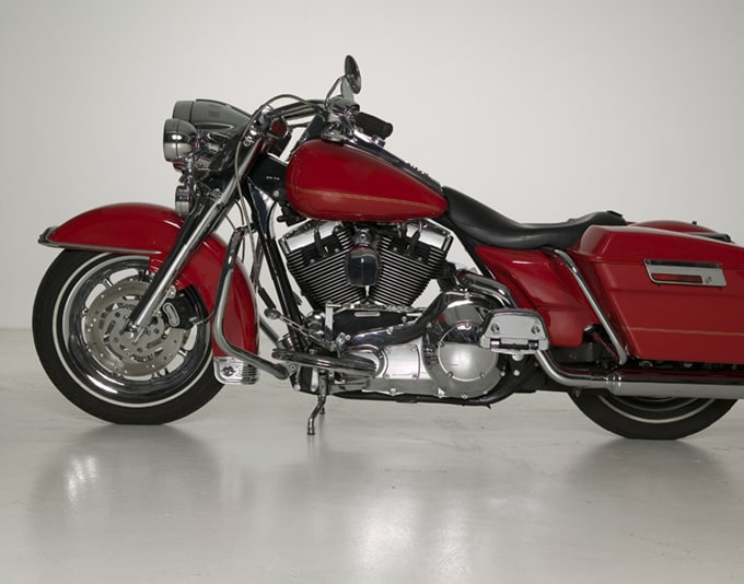
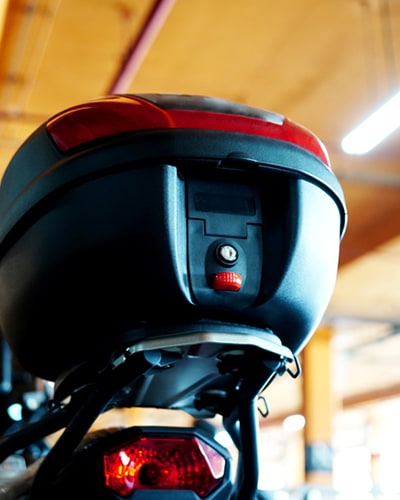
Who Needs Motorcycle Storage?
If you’re a motorcycle rider, you already know that there’s a good chance you’ll have to put your bike in storage at some point. Fortunately, Store Space has affordable, easy motorcycle storage solutions for riders who need to put their bike up for an extended period of time.


Affordable, Easy Motorcycle Storage Solutions
We offer easy and affordable storage options for motorcycles, side by sides and ATV, plus scooters and mopeds. Our storage rates and valuable move-in promotions are posted on our store pages, along with our available storage options.
When you find the motorcycle storage solution to suit your needs, complete your rental online to move in on your schedule. And with our month-to-month Rental Agreements, you can keep your boat in storage for as long as you need, without the worry of a long-term contract.
Below, we’ll list the types of motorcycle storage available, storage facility amenities, plus some tips for storing your side by side/ATV.
Nearby Locations

Resources to help you
How Self Storage Works
If you’ve never rented self storage before, we’re here to help.
Making a Reservation
Once you’ve found the right storage unit you can lock in your price by making a free reservation.
Moving In
Here’s what you need to know to make the process as smooth as possible.
Storage Features & Amentities
Thoughtful Features
Access to our properties is electronically controlled by personalized PINs, most buildings are fenced, and our interior and exterior spaces are well-lit, all to provide additional peace of mind.
Cleanliness
Let your storage experience begin with a clean storage unit at Store Space. We keep our stores and amenities clean, too, just for you.
Customer Service
At Store Space, we strive to provide you with the best self-storage experience possible. Our team members understand the needs of our guests and offer compassionate support throughout the rental process.
Speed-e-Rent
Speed-e-Rent lets you complete your rental process online in just minutes. Sign your Rental Agreement, get Tenant Protection, even enroll in our free AutoPay service, then skip the counter and go right to your unit on move-in day — it's that quick and easy!

Billing
- AutoPay available
- Major credit cards accepted
- Pay online, in-store or by phone
- Rent due on 1st of each month
Access
- Computer-controlled gate access
- Customized PIN
- Extended daily gate hours
- Your lock, your key
Administrative
- Call center open late daily
- Free no-obligation reservations
- No security deposit required
- Sign up for text alerts
Moving
- Designated unloading areas
- Large doorways
- Spacious elevators
- Wide driveway aisles
Motorcycle Storage FAQs
The cost of motorcycle storage will vary by a number of factors, but at Store Space, we post our current rates right on our store pages.
Yes, some drive-up storage units can be used for motorcycle storage. Outdoor motorcycle storage is also available, either individually or in toy haulers and trailers. Interior storage should not be used. Please check your Rental Agreement for additional details.
No, working on a motorcycle or any vehicle is prohibited in a storage unit. Please check your Rental Agreement for additional details.
Your owner’s manual should detail the steps to follow before parking your motorcycle for an extended period of time.
Store Space offers the best motorcycle storage, of course! Rely on us for affordable storage for your motorcycles and so much more.
Yes, most motorcycles can fit in a 5x10 storage unit. Make sure you measure tip to tailpipe before renting.
Reasons for Motorcycle Storage
Motorcycles mean a lot of different things to different people. Economy. Camaraderie. Danger. Excitement. Freedom. Wherever you fall on the spectrum of motorcycle ownership, there comes a time for most riders to pop the kickstand and keep the bike on ice for a few weeks, a couple of months, or even a whole season or longer.
Unless it’s your primary mode of transportation, your bike is probably going to be parked more often than not, so listed below are some of the most popular reasons for renting motorcycle storage. Also detailed in this article are some recommendations on the size of a storage unit to rent, plus the different types of storage options available.
Top 5 Reasons for Motorcycle Storage
Many riders keep their storage units year-round to have “storage on-demand,” since there are so many reasons to park the bike throughout the year.
Weather
This is the biggest reason for getting a storage unit. In most parts of the country, there is a time when it’s too cold, too foggy, or even too wet to ride year-round. If you’re in an area where the weather turns sour for a portion of the year, it’s a good idea to have a storage unit on speed dial to keep your cycle out of the elements while parked for an extended period.
Space
If you live in an apartment without dedicated cover or your house lacks adequate garage space, a storage unit serves as a great way to keep your ride out of the driveway and off the street. Add to that the ability to store your motorcycle gear and some additional household or seasonal goods, and storage makes great sense. Our facilities are well-lit and have many thoughtful features throughout, including computer-controlled gate access, fenced perimeters, and 24/7 video cameras.
Length of Contract
At Store Space, we offer month-to-month Rental Agreements, so you can store your motorcycle as long as you need, even if you’re deployed, away for school or work, or just faced with a long winter’s hibernation.
Opportunity
If you’re always on the lookout for a restoration project, having a storage unit makes it easier to pull the trigger when your next project becomes available.
Affordability
Self-storage is an affordable alternative to building a dedicated motorcycle structure on your property or investing in a Garage Condo. Take advantage of new customer move-in promotions and low monthly rates at Store Space so you’ll have more to spend on tires and leathers.
Types of Motorcycle Storage
There are a couple of storage options available for motorcycles at many self-storage facilities. Outdoor parking spaces are available for motorcycles, trailers, toy haulers, and the like. Drive-up storage units can also be used in some cases. Although less frequent, there are also dedicated indoor motorcycle parking spaces at some locations.
Outdoor parking
Motorcycles can be stored in gated, outdoor parking spots. An all-weather motorcycle cover is recommended for long-term storage. Where available, outdoor storage parking can range from car-sized up to 35 or 40 ft long, making it ideal for toy haulers and enclosed trailers.
Drive-up storage units
Many storage facilities offer drive-up storage, which is ideal for motorcycles. As the name suggests, drive-up units are ground-level with a roll-up steel door, making access fast and convenient.
Climate-controlled storage
Climate control is a feature offered in some facilities with drive-up storage. These units control humidity and temperature better, adding longevity to your motorcycle’s leather and rubber/plastic parts.
Covered motorcycle parking
Some storage facilities offer covered motorcycle parking. This is typically found in a common-space area, behind the facility’s main gated entrance.
Keep in mind that all vehicles stored within a storage facility need to have insurance and valid registration at all times. Be sure to check with the store manager if you have specific questions, and always take time to read your Rental Agreement for additional information.
Storing your Side by Side or ATV
Are you looking for storage for your side by side or ATV? Much like motorcycles, cars, RVs, boats and watercraft, Store Space has affordable options for side by side storage and ATV storage.
Drive-up storage units
These storage units are popular for storing ATVs and side by sides. As the name implies, you just drive up to the door, roll it open, and put your side by side (or trailer) inside. Make sure you rent a storage unit large enough to hold all your gear!
Outdoor parking
Where available, outdoor parking is offered in several lengths (usually 20 to 40 or more feet), making it ideal for trailers and toy haulers.
Tips for Storing Your Motorcycle
If your plans involve storing your motorcycle for any length of time, it’s important to take steps to protect it from the elements and other hazards, even if it is going to be stored inside a storage unit.
Here’s a basic list of long-term tips for storing your motorcycle at a storage facility:
- Make any pending repairs
- Clean the motorcycle thoroughly, including the chain
- Wax it
- Change the oil, oil filter and air filter
- Adjust and lube the chain (as necessary)
- Remove the battery and store in a cool, dry place
- Inflate the tires and raise the bike (if possible)
- Cover the bike with a breathable cover (or weatherproof for outdoor parking)
- Cover the tailpipe
Since this is only a partial list, it’s recommended you check your owner’s manual for other winterization and storage considerations.
Rent Motorcycle Storage at Store Space
Ride in and discover safe, affordable motorcycle storage at your local Store Space Self Storage facility. Visit our easy-to-use store locator to find the location nearest you.
Have additional questions about storage? Call or visit any of our offices or contact our Care Center at 833-786-7366, seven days a week for answers to all your storage-related questions.


